GEOCODING, real-time customer geolocation

Locate your customers and prospects in real time using their longitude (X) and latitude (Y) coordinates.

SOLUTION

Geolocate your customers and
prospects in real time

GEOCODING is an additional ADDRESS module enabling you to enhance an American or international postal address in real time with longitude and latitude coordinates. Customer geolocation is an essential aspect of geomarketing. With this data, you can map your customers and prospects in order to better understand their buying behavior. Companies can offer a point of sale, product, service, or promotion meeting the geographical characteristics of their target’s location.

GEOCODING enables you to geolocate your contacts worldwide based on the postal address and IP address after truncating for privacy.

Features

Enhancement of postal addresses in real time

Based on Longitude and Latitude coordinates. There are four levels of precision for geolocation:

  • Building or house number
  • Center of the street
  • Center of the neighborhood
  • Center of the town or city

A feature that is only available for France, it enables you to retrieve and identify the list of postal addresses based on X, Y coordinates (Latitude, Longitude).

USE CASE

Why use the GEOCODING module?

The location data provided by the GEOCODING module empowers companies to easily find exactly where their customers and prospects are located. With more precise and fine-tuned customer knowledge, you can personalize messages, strengthen marketing effectiveness, and improve customer relationships. The location of web users or mobile users can further optimize sales and marketing campaigns.

In batch mode, customer and prospect geolocation is valuable help in defining a target area, which is essential for managing development projects. A customer profile developed based on precise location data enables you to discover new sales opportunities and make better-informed strategic decisions.

The benefits of the GEOCODING module

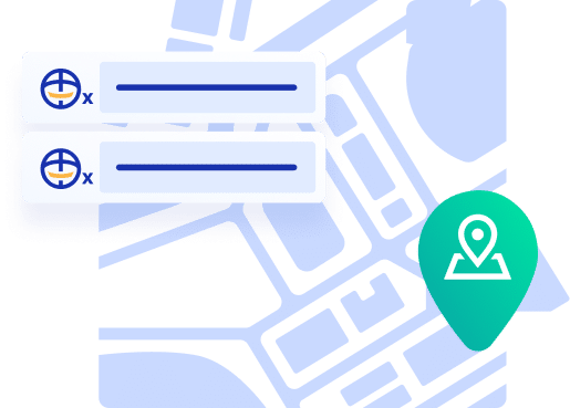
Pinpointed geomarketing

Implement a sectoral analysis to provide a personalized adapted to the customer’s location in real time.

Target area

Identify geographical areas with high commercial potential indicating the concentration of your target contacts.

Statistical studies

Carry out statistical studies containing local social and economic data based on X, Y coordinates.

Go further with GEOCODING

Mastering customer geolocation

Geocode your customers’ addresses, an asset to better personalize relationships

Deduplicate Icon

Geolocation to better know your customers

Geolocation by geocoding the postal addresses of customers allows a visualization of buyers by specific geographical area. Via postal addresses providing constant latitude and longitude references, you can build a precise map of your customer base. Geolocation helps you better understand the context of customers and, by extension, of potential buyers by associating public data such as land registry with their location. Thus, the collection of location data contributes to a more accurate knowledge of your customers.

Customer geolocation for your marketing actions

Generating a customer map provides a more accurate visualization of different buyer profiles. By generating a thematic map, customer location helps refine your campaign segmentation and better personalize communications with your customers by giving the right message to the right person. For example, by identifying people who live within walking distance of a city center, your marketing campaigns aimed at this segment of contacts can link to nearby brand point-of-sales..

Customer geolocation to contextualize sales

By combining public and anonymized socio-demographic data with a customer's location, it is possible to establish a much more relevant commercial relationship with offers adapted to the customer's environment. For example, identifying high-potential buyer areas allows you to propose adapted and localized promotions in nearby sales outlets. Thus, geolocation proves useful to customers by facilitating access to offers, accelerating the sales process, and helping to increase the average shopping basket.

Customer geolocation for CRM optimization

Collecting customers' address data and geocoding it to better locate them gives your CRM and customer service departments an additional tool for managing customer relations. Geolocation brings more precision in the relationship with the possibility to understand the profile, the context (for example, polluted area, at risk, district or street with high traffic, or similar), and the catchment area. The result is services and offers adapted to reinforce customer satisfaction and retention.

Geolocation to put the customer at the center

Geolocation provides a real benefit to customers by taking into account their location and environment in interactions with your brand. As a relational lever for marketing campaigns, for sales teams, for CRM management, and for customer service, geolocation is at the service of the customer experience and contributes to the customer-centric enterprise. Among its tangible benefits are various optimizations of customer follow-up, better targeting, and higher average shopping basket.

FAQ

Geocoding is the process of converting a postal address into geographic coordinates — a latitude and longitude pair. It works by matching the address against a reference database of known locations and returning the corresponding GPS position. The result can be used to plot customers on a map, calculate distances, assign territories, or feed any system that requires a spatial coordinate rather than a text address. Reverse geocoding does the opposite: it converts a set of coordinates back into a readable address. 

Address verification checks that an address is real, correctly formatted, and deliverable — it confirms the address exists in a postal database. Geocoding goes one step further by attaching geographic coordinates to that address, enabling spatial analysis. The two are complementary: verifying the address first ensures the geocoding result is accurate, since geocoding an invalid or malformed address can produce imprecise or misleading coordinates. DQE’s GEOCODING module is designed to work on validated addresses for maximum precision. 

Geocoding unlocks a wide range of location-based decisions: defining sales territories and assigning customers to the nearest sales rep or store, optimizing delivery routes and logistics planning, analysing the geographic distribution of customer churn or high-value segments, targeting local marketing campaigns, measuring the catchment area of physical stores, and identifying underserved areas for expansion. Any decision that depends on where customers are located — rather than just who they are — benefits from having reliable coordinates in the customer database. 

Geocoding accuracy depends on the quality of the input address and the reference database used. A fully validated, standardized address typically geocodes to rooftop or street-number precision — placing the point at the specific building. A partial or ambiguous address may only resolve to street-level or postal code centroid precision, which can introduce errors of hundreds of meters to several kilometers. Using validated addresses as input and a high-quality, regularly updated geocoding engine — like DQE’s GEOCODING module, which covers over 240 countries — maximizes positional accuracy. 

Both. Batch geocoding applies coordinates to an existing database in a single processing run, enriching all records that have a valid postal address. Real-time geocoding can also be triggered at the point of address entry, immediately attaching coordinates to each new record as it is created. For most organizations, the practical approach is to run an initial batch geocoding pass on the existing database, then apply real-time geocoding to all new entries going forward. 

Perform a search